Geomorphology
- Summary of Studies Supporting Cumulative Effects Analysis of Upper Yellowstone River Channel Modifications (2004)
This was performed by the USGS, Fort Collins Science Center and was sponsored by the Army Corps of Engineers. - Channel Migration Zones and Floodplain
- Channel Migration Zone GIS Data (2009). Download in ESRI geodatabase format
- Yellowstone River Channel Migration Zone Maps
- Yellowstone River Channel Migration Zone Final Report (2009)
- Bank and Flowline GIS Data for 1950 (entire length of river corridor, MT), 1976 (Sweet Grass County to confluence with Missouri River), 1995 (Sweet Grass County to confluence with Missouri River), 2001 (entire length of river corridor, MT). 2015 (Reed Point to Custer, MT), and 2023 (Park County to Custer County).
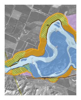
- 100-year Inundation Boundary GIS Data (2007)
- Geomorphic Parameters and GIS Development
These two reports document the results of a GIS analysis performed in support of the geomorphic scope of work associated with the Yellowstone River Cumulative Effects Assessment. The work consists of a GIS-based summary of geomorphic planform parameters of the Yellowstone River corridor from Gardiner to the Missouri River confluence. Primary reach breaks and reach classification data reflect those presented in the Geomorphic Reconnaissance and GIS Development for the Yellowstone River.- Work Order Number 1 (2006)
- Work Order Number 3 (2007)
- Geomorphic Reconnaissance and GIS Development for the Yellowstone River (2004)
Report and GIS datasets - Yellowstone River Geomorphic Analysis for Yellowstone County (2000)
Prepared for the Yellowstone Conservation District by Womack and Associates, Inc. and Aquoneering, Inc., this report assesses the effects of erosion and flood control structures on the Yellowstone River’s geomorphology from the Carbon County line to the eastern edge of the Billings East USGS Quadrangle. Principal sources of data include historic aerial photography (1957 and 1999) and survey data obtained by the report authors (1999) and the US Army Corps of Engineers (1968).
Yellowstone Clearinghouse Home
Yellowstone River Final Reports
- Cumulative Effects Analysis (CEA)
- CEA Technical Appendices
- CEA Executive Summary
- Reach Narratives
- Recommended Practices and Position Statements
- Governor's Upper Yellowstone Task Force (1997-2003)
Maps
- Online Map Viewer
- Reach Story Map 1: Overview
- Reach Story Map 2: Details
- Yellowstone Reference Maps
- Maps Selected from Technical Reports
Data and Technical Reports
- Imagery and Topographic Mapping
- Hydrology and Hydraulics
- Land Use and Physical Features
- Geomorphology
- Biology
- Socioeconomics
- List of Available GIS Data
Contact Info